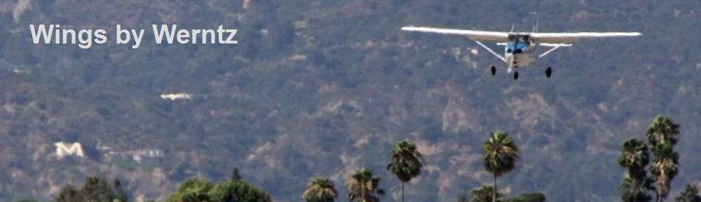
Most of you are probably too young to remember (or even to have heard) the song by the Four Preps:
Twenty-six miles across the sea
Santa Catalina is a-waitin’ for me
Santa Catalina, the island of romance
Romance, romance, romance
The song speaks to the lure of this member of the Channel Islands that’s so close to Los Angeles. This island is especially luring to pilots, with a publicly accessible airport. However, the island and airport hold some surprises for the unprepared pilot; as a result, our club requires that pilots have a checkout before operating at the Catalina (AVX) airport:
Because of unusual local conditions, to act as pilot in command of an AACIT aircraft unaccompanied by a club-approved instructor, landing at or departing from the following airports, a pilot must have received a checkout for that airport from a club approved instructor or have the express approval of the Flight Director. (Rule IV.B.9)
The goal of the checkout is to familiarize pilots with appropriate planning, operations, and the special hazards present at Catalina. Pilots should expect to do at least 3 landings on the day of the checkout and go-arounds are very common. Since you have to stop to pay the landing fee ($38/day in 2024 – if you plan to go regularly, I recommend a membership), I suggest also allocating time for lunch at the Airport In The Sky Restaurant on the day of your checkout.
Over water operations
For most pilots in Southern California (most pilots in general?), flying to Catalina will be the first time you intentionally operate an aircraft in a situation where you might not be able to glide back to shore. [For extra credit – how high would you need to fly to guarantee gliding and where would you land on Catalina, besides the airport?]
Club rules state that “one life vest per occupant is required for all over water flights that are beyond gliding distance to land”. To ease compliance with this requirement, the club has flotation devices available for use by members and their passengers for free. They may be reserved through ScheduleMaster and are kept in the green box.
Another topic for over-water operations is “ditching”, should you experience engine failure and be unable to make it back to land. See the AIM section on ditching or these other articles (http://www.equipped.org/ditchingmyths.htm and http://www.equipped.org/bschiff-ditching.htm)
Routes
If you draw a straight line from EMT to AVX, you’ll find it is about 45nm. I wouldn’t recommend that exact direct route. There are a number of routes that pilots use, but it depends on your goal
- Follow the 605, cross Long Beach at midfield and fly direct to Two Harbors. This is my most common and is most direct route I take. This does force you to fly lower and more precisely to avoid the LAX Bravo airspace until clear of, or cleared into, the Bravo. I personally fly no higher than 2200′ MSL under the 2500′ shelf of the Bravo and may need to be lower if jets are down low in the Bravo (watch out for wake turbulence). If I request flight following from EMT, they will usually hand me over to SoCal on 124.9 (this is the controller for the final approach frequency at LAX, so can be very busy); I frequently am cleared into the Bravo once I get past the LAX final for a climb to 4500. A different option is to stay low and call LGB tower for a transition, climbing as a I cross over LGB and then contacting SoCal for flight following the rest of the way.
- Head towards FUL and then AVX with appropriate altitudes to stay clear of LAX Bravo. 3500’MSL usually works on the way to KFUL and then you could climb to 4500′. If you want to climb to 6500′ that would require waiting until you’ve gotten south of SLI or getting a Bravo clearance.
- Head to POC and then AVX. This gets you far enough east to allow higher altitudes below the LAX Bravo. Some pilots will do a touch and go at POC to turn this into cross country that meets the 50nm requirement
- Turn it into a full tour, flying towards SMO, through the LAX mini-route and around Palos Verdes to AVX
In general, plan to stay clear of LAX Bravo and be pleasantly surprised if you are cleared in. I suggest contacting SoCal for flight following.
Catalina (AVX) airport – approach, landing and hazards
Wind and runway configuration usually favor the use of runway 22, especially for landing. The typical approach for RW22 is to fly to Two Harbors and fly inbound to the airport on the 45 entry from there. On nice weekend days, the pattern at AVX can be very busy, hence the recommendation for full traffic and for brief but informative position reporting. Catalina has automated weather reporting, as well as someone who generally responds to Unicom requests for information about traffic inbound and outbound, as well as conditions. Some pilots will confuse unicom for a tower controller (it is not).
The runway at AVX was created by basically leveling two mountains and filling in between to make a plateau. The runway is shorter than El Monte (approx 3000 ft long), has effectively no overrun areas, and drops quickly from an altitude of 1600 feet to sea level at both ends. As a result, the airport is very unforgiving to pilots who land long or land short. Precision in landing and a pre-disposition to a “go around” is recommended.
As a result of relationship of the airport to the terrain, many normal visual cues for approach are missing or confusing; pilots should concentrate on an appropriate aiming point on the runway surface and utilize approach lighting if available (it is an unusual type at AVX – a pulsating VASI [solid white is the preferred indication]). I aim for the numbers and plan for a slightly steeper than normal approach to deal with possibility of wind caused downdrafts and turbulence. With the location on a plateau, turbulence and downdrafts are to be expected (think about how the wind will flow if you are landing into the wind). If winds are strong, expect strong downdrafts on final.
Runway 22 slopes up at nearly 2%; this presents a performance challenge on takeoff and a visual cue problem on landing (can fool you into thinking you are higher than you are). There is a hump in the middle of the runway, such that pilots are unable to see the opposite end of the runway; some pilots have erroneously thought they were reaching the end of the runway, when in reality they had 1000 feet or more left. This hump also means that pilots at opposite ends of the runways cannot see each other – radio calls are mandatory as a result. Many pilots will use runway 4 for departures, as the downhill helps performance and points you towards the mainland (I don’t recommend this on busy days where pilots are landing on runway 22)
Runway and taxiway condition – over the years, the condition of the asphalt has varied from “OK” to horrible. It’s important to realize that potholes, soft spots, dips, and rock/asphalt debris are all likely hazards and pilots must use appropriate takeoff, landing, and run-up techniques to avoid damage to landing gear and propellers. Soft (rough) field technique should be used. Run-ups are typically done on the taxiway – be aware of other planes and debris.
Marine layer – the marine layer can move in very quickly, trapping even IFR rated pilots. Be aware of changing conditions and be sure to have a thorough weather briefing. Be cautious of the clouds/fog on the south side of the island that can quickly flow up and over the runway, especially later in the afternoon.
Important Restrictions
- Full stop landings only (no touch and go’s)
- Landing fee ($38 as of 2024)
- Operating hour restrictions (8:00 a.m. – 5:00 p.m.).
Pingback: I Love (touring) LA (from the air) | Wings by Werntz